

 BANNER
 BANNER
 BANNER
 BANNER
 BANNER
 BANNER
 BANNER
 BANNER
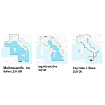


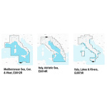
Essential details, including the port plans, bathymetry, list of phone numbers and much more. Hundreds of thousands of changes by the Navionics Community viewable on some GPS plotter, compatible with Freshest Data. Access to any cartographic layers in the region purchased SonarChart ™, the bathymetric map HD Navionics that reflects the ever-changing bottom conditions. Auto-routing, SD / Micro SD memory media. Verify that the instrument is capable of reading MSD-SD memory media greater than 2 GB in capacity.
| Peso | 0,10 kg |
|---|---|
| Dimensões (C x L x A) | 10,7 × 1,3 cm |
Produtos Relacionados


Em stock

Em stock


Em stock


Em stock


Carta original garmin BlueChart g3 Portugal e Noroeste Espanha HXEU009R
Em stock


Em stock


